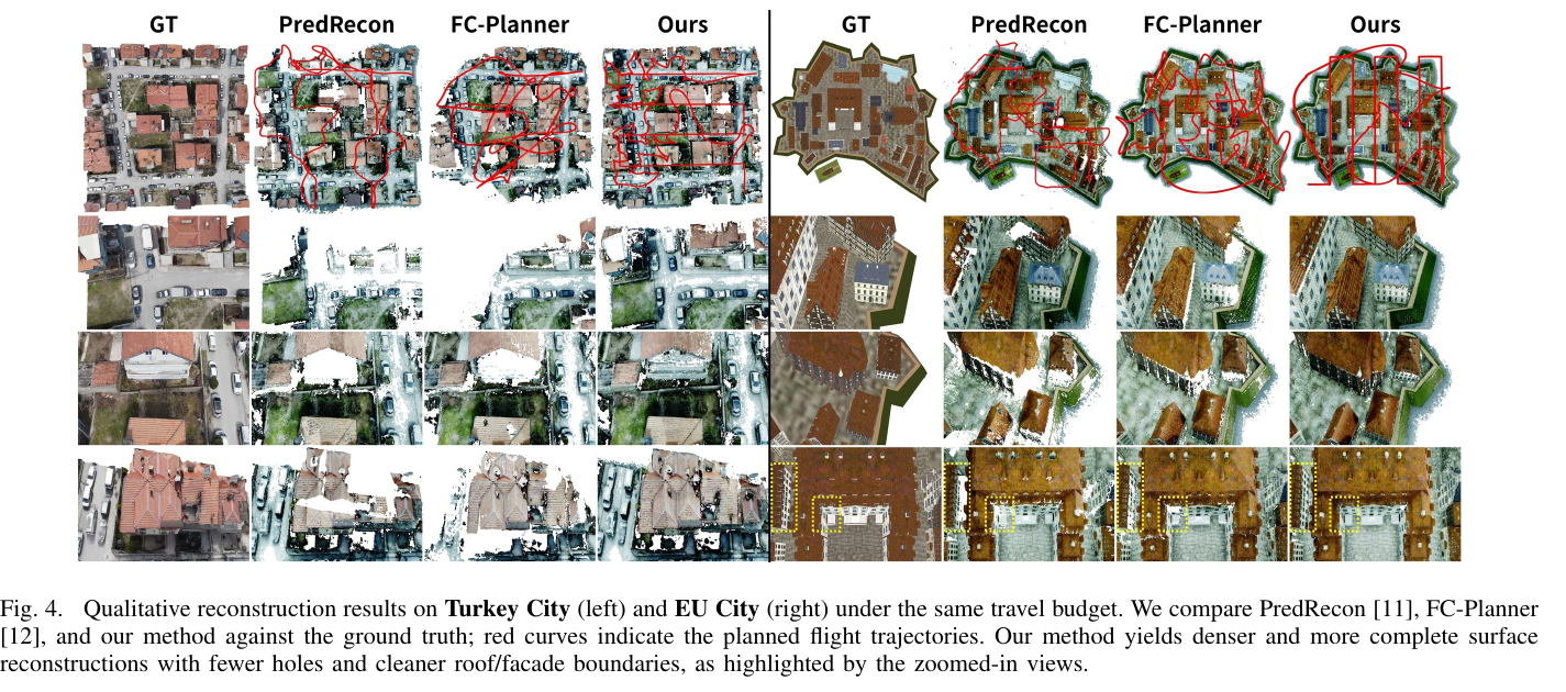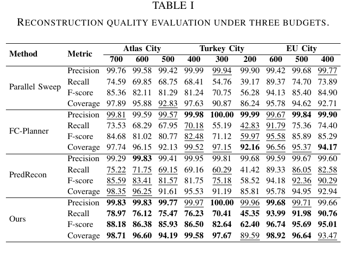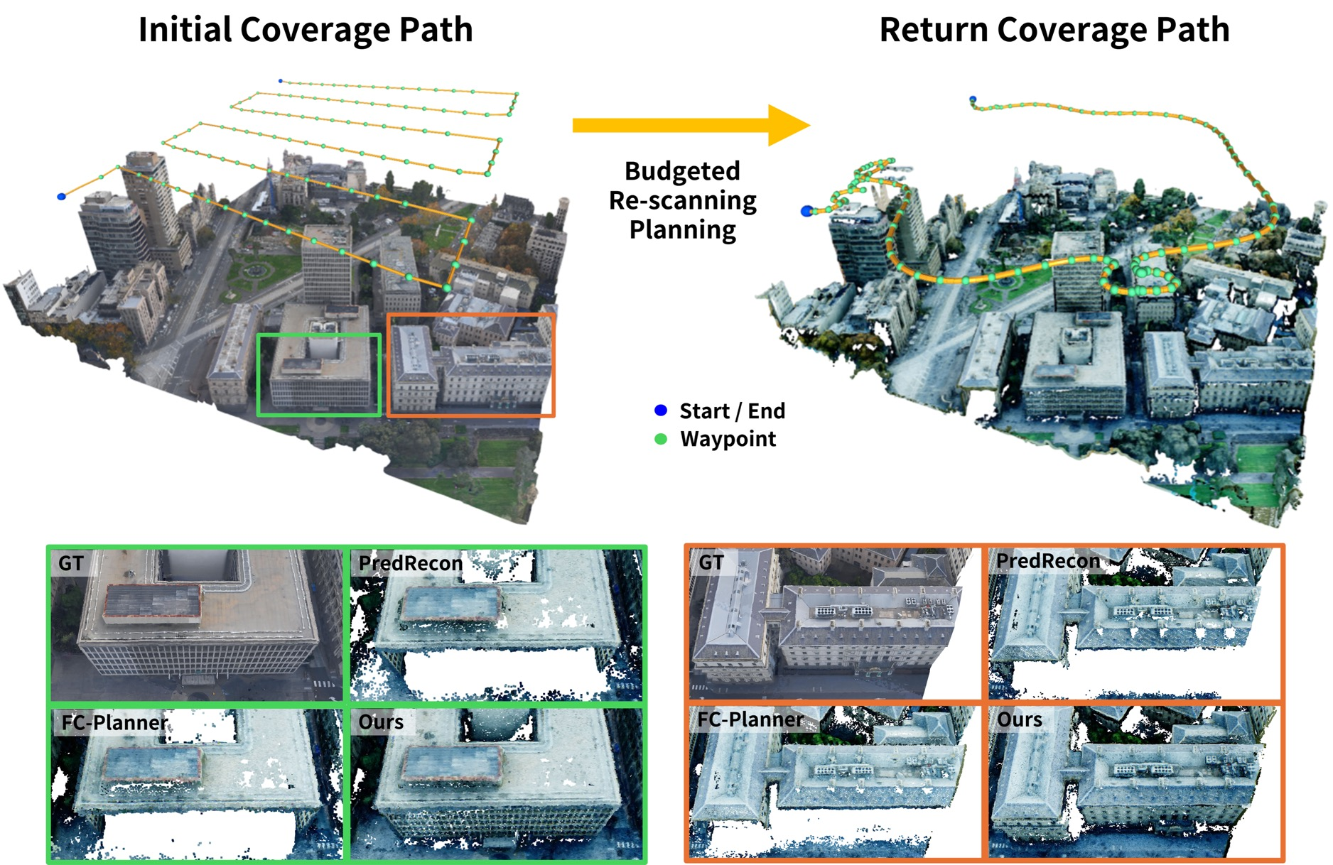
UAV photogrammetry efficiently reconstructs large scenes, but flight-time constraints often leave coverage gaps that require costly revisit missions. Conventional explore-then-exploit workflows address this issue through an initial scan followed by targeted re-scanning, but they typically suffer from batch reconstruction latency and manual inspection. Recent online planners reduce this delay by adapting viewpoints during flight; however, frequent short-horizon updates can limit global route quality and cause repeated trajectory modifications. We propose an online explore-then-exploit framework that completes initial scanning and targeted re-scanning within a single flight. During outbound exploration, the UAV follows a preplanned route, while captured imagery is incrementally processed to update a 3D proxy model, evaluate surface coverage, and identify under-scanned targets. For return re-scanning, we combine sector-level budgeted routing with global refinement using an Adaptive Large Neighborhood Search optimizer to maximize coverage gain under a fixed travel budget. By overlapping reconstruction, target extraction, and route refinement with outbound flight time, the proposed method generates high-quality return paths without requiring a prior 3D model or a separate revisit flight. Urban-scale simulations show consistent improvements in reconstruction completeness over state-of-the-art baselines under identical travel budgets.